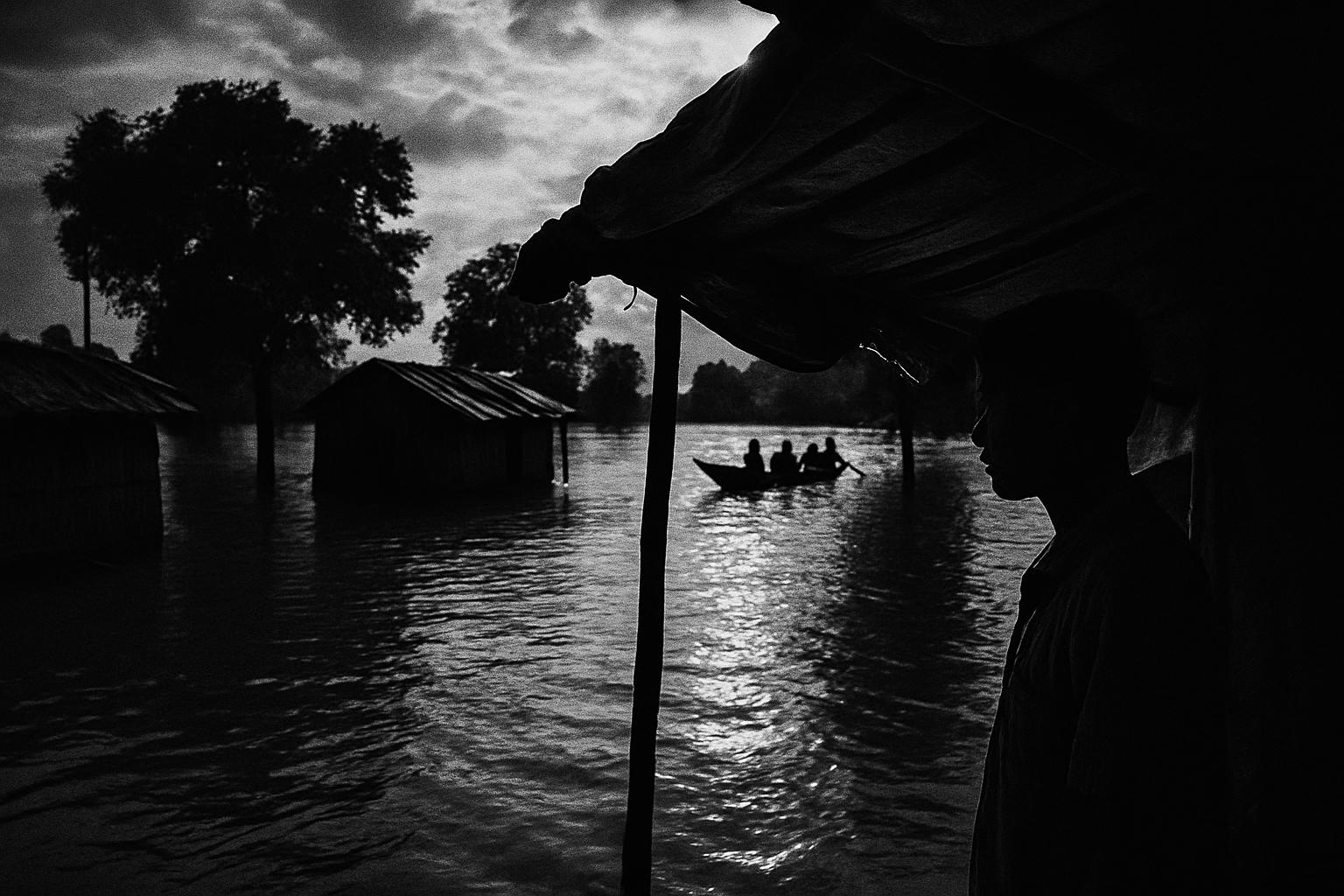
Assam’s Flood Ledger: 47 Dead, Over 6.5 Lakh Affected Across 11 Districts
Assam’s Flood Ledger: 47 Dead, Over 6.5 Lakh Affected Across 11 Districts
Assam’s latest flood bulletin reports 47 dead, more than 6.5 lakh people hit across 11 districts, and 939 villages under water, sharpening the focus on boats, shelters and medical teams as embankments and evacuation plans face a fresh audit.
 Veera NairTET TV Anchor — India Desk
The monsoon arithmetic in Assam is unforgiving, and the latest official ledger is stark. The Assam State Disaster Management Authority has confirmed 47 deaths, with more than 6.53 lakh people affected across 11 districts, and six persons missing. A total of 939 villages under 40 revenue circles remain inundated. Waterlogging has also hit parts of Guwahati, a reminder that the flood story spans both rural char lands and urban lanes.
The geographic footprint matters for relief math. The affected districts in this wave are Karbi Anglong, Golaghat, Charaideo, Kamrup, Sivasagar, Jorhat, Dibrugarh, Nagaon, Dhemaji, Hojai and Kamrup Metro. Within this map, the burden is sharply concentrated. Sivasagar is the worst hit with 3,92,195 people affected, followed by Charaideo with 1,10,755 and Jorhat with 97,690. Golaghat and Dibrugarh add 25,591 and 13,390 respectively. That means roughly six lakh of the reported affected are in the three hardest hit districts alone, compressing demand for boats, shelters and medical teams into a relatively tight corridor.
More than 6.53 lakh people are affected across 11 districts, and 939 villages remain inundated.
Two operational signals stand out. First, the scale of village inundation spread across 40 revenue circles points to a dispersed logistics problem rather than a single breach that can be ring fenced. Second, the tally of six missing underscores the need to refine search-and-rescue protocols and community alerting, particularly where waters rise quickly after upstream cloudbursts. The chief minister has linked this surge to a cloudburst in neighbouring Nagaland, and he has noted that an inter-ministerial team from the Centre is being dispatched, which should tighten coordination across agencies.
Where the water is, and what that implies
Sivasagar’s numbers demand priority routing. If nearly four lakh people in one district are affected, relief planners must assume that evacuation routes, ration distribution and healthcare are all running at capacity. The next two districts, Charaideo and Jorhat, push the corridor total to about six lakh. Boats and high-clearance vehicles have to cycle repeatedly in this zone, which in turn requires secure fuel supply, clear staging points and predictable communication between circle officers and camp coordinators.
In Golaghat and Dibrugarh, the reported caseload is lower, but that does not translate into easy operations. Smaller pockets can be fragmented, and 939 inundated villages indicate multiple micro theatres of response. If waterlogging in Guwahati is added to the map, even a well stocked state warehouse can find its dispatch windows tightening because urban traffic disruptions ripple into rural supply chains.
Water levels in the Brahmaputra and several tributaries are rising at multiple locations. For field teams this means two clocks are running at once. The first is the search-and-rescue clock, where missing persons reports must be reconciled quickly with local panchayat lists and relief camp registers. The second is the protection clock, where temporary bund repairs, sandbagging and culvert clearances buy time for habitations that are not yet cut off. Every hour saved here shortens the queue for rations and medical care tomorrow.
Embankments and evacuation planning, the questions that matter now
The current bulletin does not catalogue embankment performance or evacuation timelines. That gap sets the agenda for a quick audit. Relief managers can ask three simple questions in each revenue circle. One, did early warnings and community messaging reach the last mile in time to move the elderly, children and the infirm before roads went under. Two, did designated shelters and relief camps open with water, sanitation and medical stocks adequate for at least 48 hours. Three, did embankment watch-and-ward teams log seepage, sloughing or overtopping events in a way that could be acted upon the same day.
These are not abstract checklists. The fatality count of 47 and the six missing point to a premium on lead time. If a village is on an at-risk list, shuttle buses, tractors and boats must be pre positioned, with fuel and operators assigned. If a riverbank segment is flagged, it needs round-the-clock visual patrols and a clear call tree for public works, police and revenue officials. The inter-ministerial team can help benchmark these practices across districts so that hard lessons in one circle are transferred immediately to the next.
Last mile logistics, translated into numbers
With 939 villages affected, even a modest one trip per day service to each pocket implies close to a thousand sorties daily, before accounting for repeat runs. If just the three worst hit districts account for about six lakh people, and an average relief camp aims to serve 1,000 people, that is a planning baseline of hundreds of camp units, plus mobile health teams rotating through them. These thumb rules clarify why delays cascade, and why road cut offs or ferry stoppages in one node can trigger shortages two circles away.
Guwahati’s waterlogging is a separate operational signal. Urban inundation competes for the same pumps, excavators and personnel that rural districts need, and blockages on arterial roads can slow consignments headed to staging yards. Ringfencing urban dewatering assets and setting fixed dispatch windows for rural loads can reduce these clashes.
What to watch in the next 72 hours
Three indicators will tell us if response capacity is keeping pace. One, the active case load trajectory in Sivasagar, Charaideo and Jorhat. If the affected headcount there stabilises, logistics can pivot to depth rather than breadth. Two, reconciliation of missing persons lists with camp rolls. Rapid closure here means search-and-rescue loops are working. Three, the tempo of central state coordination as the inter-ministerial team lands. Clear tasking and daily situation reports can shave hours off procurement and deployment.
Assam has seen flood adversity before, and the present bulletin is a sober tally rather than a retrospective. The numbers are precise, and they tell us what matters now. Concentrate assets where the headcount is largest, keep the supply lines predictable across 40 revenue circles, and translate every hour saved into safer evacuations and steadier camps. That is how this monsoon ledger can be balanced, one district at a time.